Click Tabs under CENTRAL OREGON 2023 (menu across page top) to view General Info, Registration, Lodging, Social Events, Walks, and Souvenirs.
Walk and Bike Events 2023

|
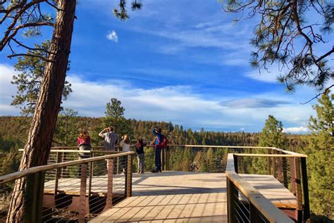
Terrebonne (Smith Rock) - Monkey See, Monkey DoUnavailable because of construction.
Event #123883 24 miles N of Bend on Hwy 97 5km, 10km - 2B (Monkey Face option 3C) Parking: $5/day or Oregon State Parks permit (available on site). Walk on trails along the slow-moving Crooked River with sweeping views of the walls and spires that rise from the canyon, opportunities to watch rock climbers, and see the iconic Monkey Face. Along your trip through the canyon, you might see golden eagles, prairie falcons, mule deer, river otter and beaver. Those who like to climb up a bit for breathtaking views (600-foot elevation change to the summit) can opt for the Misery Ridge Trail. |

|
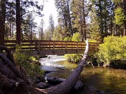
Redmond - Parks and TrailsEvent #124693
18 miles N of Bend on Hwy 97 5 km - 1A, 10 km - 2B (92 stairs toward end of 10 km route) Enjoy a section of the new Homestead Canyon Trail through seven parks, including the Dry Canyon Trail with a new disc golf course in the canyon. Look for climbers on Maple Bridge, and return checking out some food carts and public art. |
|
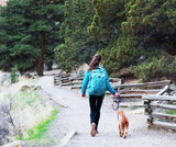
Bend - Git around the block, Buster!Event #124266
5km, 10km - 2B Enjoy a stroll through the vibrant downtown and quiet city parks, past the impressive Vietnam Memorial, and along the scenic Deschutes River Trail. Enjoy the quirky twist to this walk as you pass by the last remaining Blockbuster video store on earth – featured during this year’s Superbowl. If the video is still posted, you can view the ad at Blockbuster. |
|
Bend - Lava Island (aka Walk to the Raft)Event #124267
5 km, 10 km - 2B Starting at Seventh Mountain Resort, follow along the banks of the Deschutes River to where those going rafting will load into their boats. You will be treated to fantastic views of the river, the plant and wildlife in the area, and some amazing lava flows as well. Walkers not going rafting will make this route an out/back. (Note that the fee for rafting does not include the fee for the walk.) More rafting info NOTE: The rafting portion of this event is not sanctioned. |
|
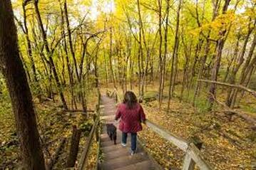
Bend - Shevlin ParkEvent #124269
5km - 1B, 10km - 2B A forest walk that includes huge larch and old-growth ponderosa, and several footbridges along Tumalo Creek. The longer route follows the canyon rim, includes a few short, steep hills, and crosses Tumalo Creek twice. The 5 km route follows the creek upstream passing a beach and several swimming holes. It is delightfully shady and cool on a warm afternoon. |
|
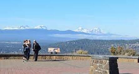
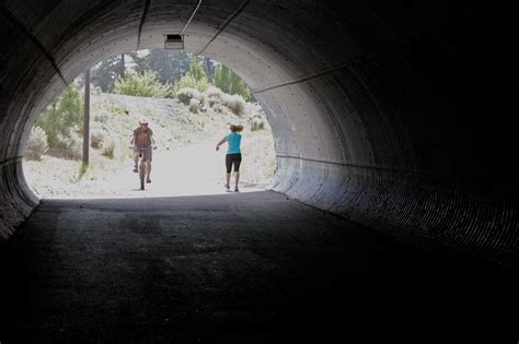
Bend - Pilot ButteEvent #124268
6km - 2B, 11km - 2B Pass through juniper and sage stands and parks to an ancient cinder cone that affords views of Bend, panoramic views of the Cascades, and the great expanse of Central Oregon in the distance. The trail is mostly off-street and features a tunnel below Highway 20. Once at Pilot Butte State Park, the 5 km route follows a trail that winds around the extinct volcano while the longer route offers options for going to the top for the spectacular views. |
|
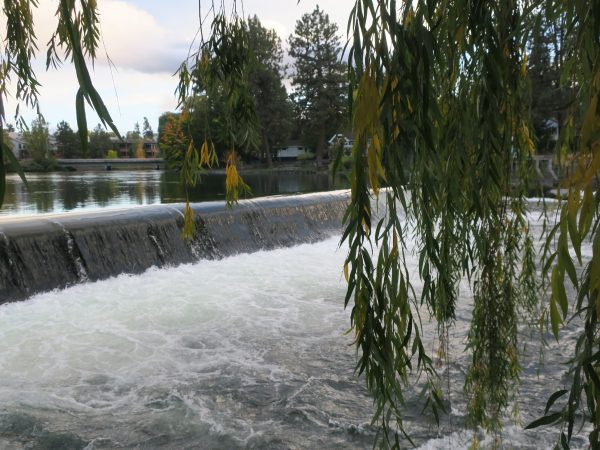
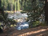
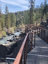
Bend - Benham Falls to Dillon FallsEvent #124265
Up to 15km - 2B Parking: $5/day or NW Forest permit (available on site). This spectacular section of the Deschutes River Trail has views of some impressive whitewater and old growth ponderosa pines. An opportunity to walk as far as you'd like past Benham Falls to several Day Use Areas and then to Dillon Falls and back |
|
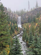
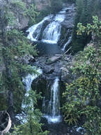
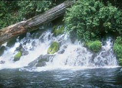
Tumalo FallsEvent #124270
14 miles W on NF-4601 and NF-4603 - Unpaved roads 6 km, 10 km, and longer options - 2B Parking: $5/day or NWForest Pass permit (available on site). Several distance options depending upon level and how many waterfalls we want to see. The nearly 100-foot falls pour over the edge of ancient lava rock, plunging into Tumalo Creek below and are visible from the trailhead. After a few switchbacks you will reach the spectacular Tumalo Falls overlook platform just 0.25 miles from the trailhead. Returning to hike up the North Fork Trail, we pass a total of seven cascading waterfalls, continuing up the creek into a mountain hemlock, spruce, and lodgepole pine forest. After Double Falls, the trail moves farther away from the creek in a dense wood. The trail is moderate with an elevation gain of 1460 feet and well-maintained. Bike traffic on North Fork Trail is permitted in one direction only, going uphill. |
|
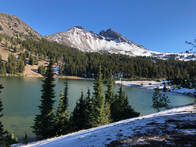
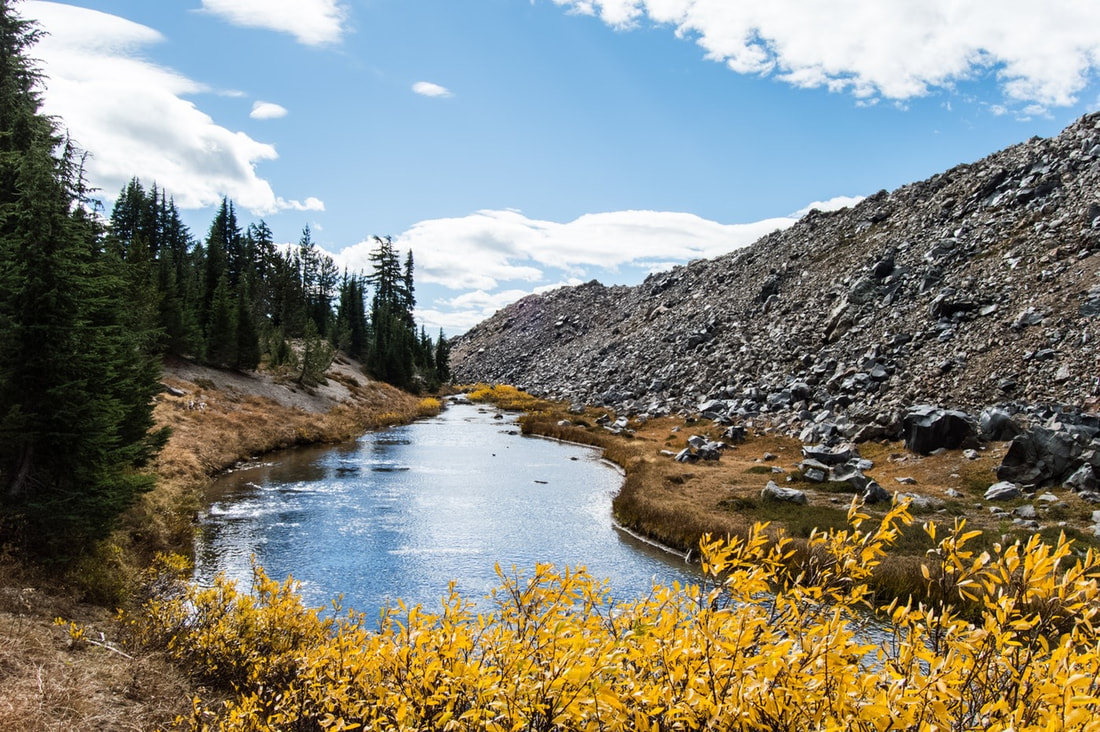
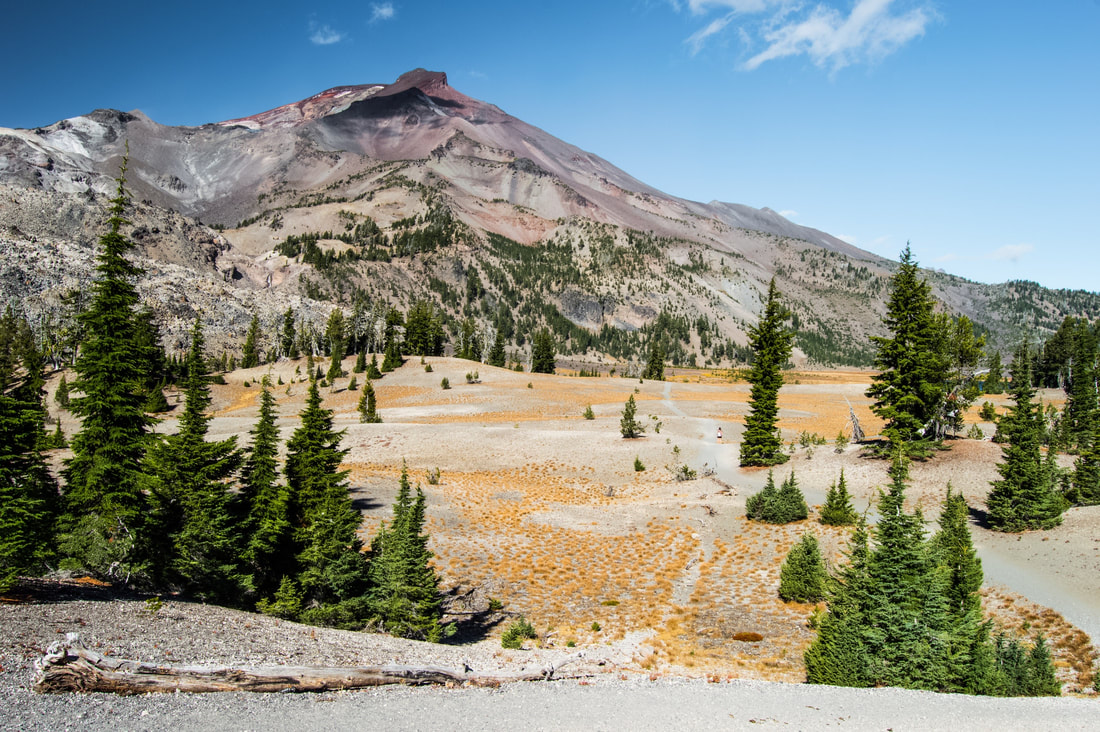
Green LakesEvent #124272
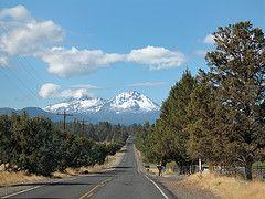
27 miles W of Bend on Cascade Lakes National Scenic Byway 5km, 15km or further - 3B Parking: $5/day or NW Forest Pass (available on-site) A Central Cascades Wilderness Day Use Permit is required for entry. The permits are nontransferable and only valid for entry on date and trailhead listed on the permit. Cost is $1. This is NOT the parking pass. To purchase: www.recreation.gov/ticket/300009/ticket/2003 Winding through the Three Sisters Wilderness, the trail gradually climbs beside Fall Creek, passes by dozens of picture-perfect waterfalls, and lava flows, to alpine meadows and the lakes with their vast views of South Sister, Mt. Bachelor, and Broken Top. Distance depends upon desire. To the lake and back is 15 km and takes an average of 4 hours. The terrain is moderately difficult, there is not much elevation gain (1,273'), and the hike can be done easily if taken slowly. You get the best of both worlds, mountain views and alpine lakes. |
|
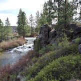
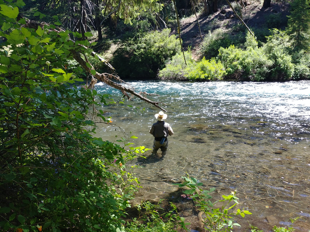
Camp Sherman - Metolius RiverEvent #124271
40 miles NW of Bend on Hwy 20 10km - 2B From Wizard Falls Fish Hatchery, walk downriver along the beautiful Metolius River known for fly fishing and cold, clear water, and then cross Lower Bridge and return, passing through a forest of pine, fir, and cedar trees. The Metolius River, officially designated a National Wild and Scenic River, is best known for fly fishing. The trail generally follows along the edge of the river with good views of it rushing by. Expect to see easy rapids, fly fishermen, birds, possibly fish, and other wildlife. The hike is circular so that we can enjoy both sides of the river. The paths are level and clear with a gradual incline. At the Wizard Falls state fish hatchery, view open ponds of fish. Fish food is available. Wizard Falls itself is a modest rapid over a ledge in the river. |
|
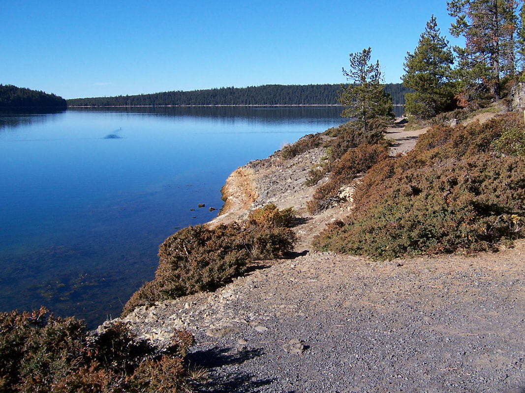
Bend - Riley Ranch to Tumalo State ParkEvent #124273
<5 Miles NW of Bend 5km, 11km - 2C 5 km route only: $5/day or Oregon State Parks pass Riley Ranch Nature Reserve is 184 acres of former ranch land featuring 35 acres of canyon floor along the Deschutes River and a 30-acre band of rimrock cliffs. From the open meadows of the nature preserve, descend one steep switchback to get to the canyon floor and the Riley Ranch Trail to hike along the Deschutes River to Tumalo State Park. Return to the Lower Canyon Loop Trail weaving through the forests of the river canyon and has several river access points, then back up the steep switchback to the upper portion of the reserve and easy walking loops that feature a viewing deck that offers stunning views of the river and canyon below, as well as the skyline and mountains. (NOTE: This event is not near Tumalo Falls.) Dogs not allowed in the nature preserve. The shorter route (5 km), which starts in Tumalo State Park and goes along the river to the boundary of the Reserve, is available to those with dogs. |
|
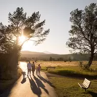
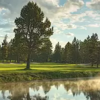
Sunriver - Village and LoopsEvent #123859
17 Miles S of Bend on Hwy 97 5km, 10km - 1A Beginning at The Village with its variety of stores and restaurants, explore the scenic Sunriver Resort and residential community (elevation 4,160’) laced with flat paved trails running through Ponderosa pine forest. Pass the lodge, numerous homes, the aquatic center, championship golf courses, tennis and pickleball courts, and the Deschutes River. Stop for a rest and view wildlife at Lake Aspen and perhaps visit the Nature Center and Observatory. Afterwards you’ll not want to miss treating yourself to ice cream at Goody’s or eating at one of the many restaurants. |
|
LaPine - Paulina Lakeshore TrailEvent #123882
30 Miles S of Bend on Hwy 97 13km - 2C Parking: $5/day or NWForest Pass (NOT available on site) This trail is a moderately difficult hike located within the scenic Newberry Volcanic Monument area. Elevation is at 6,350' at the trailhead start. The lake fills what was once a violent fiery caldera formed in a series of eruptions over a half-million years, the last of which was 1,300 years ago. Today, the forested trail circumnavigates the serene blue lake, mostly flat with some uphill sections. Pass by outcroppings of black obsidian glass formed during the eruptions and enjoy the view from the trail as it gently rises high atop a red cinder scree field at the edge of the lake. Keep an eye out for bald eagles and if you’re lucky, you may see a fisherman land a trophy brown trout from the blue depths. While there, enjoy lunch at the lodge and make a day of it by visiting the Big Obsidian Flow – just a short walk from the park road, or driving to the top of Paulina Peak for truly spectacular views of Central Oregon. |
Bikes
|
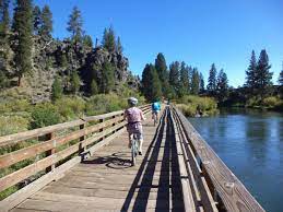
Tumalo - Twin BridgesEvent #124264
Route <20 miles 8 Miles NW of Bend on Hwy 20 Ride a portion of the Twin Bridges Oregon Scenic Bikeway out of Tumalo park toward Sisters on backroads with fantastic views of the mountains. This one has some uphill sections, so it's not suited for folks who don't ride much. |
|
Bend - Sun-Lava PathEvent #124263
Route 11 miles Parking: $5/day or NWForest Pass (available on site) Ride the Sun-Lava paved trail from the Lava Lands Visitor Center to the Benham Falls area (Those with mountain/hybrid bikes could do that out-and-back section also), down to Sunriver and back. |
|
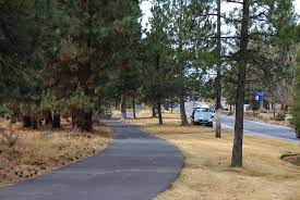
Bend - Century DriveEvent #124262
Route 10km Cruise along a paved bike trail on the outskirts of Bend enjoying the pine forests and typical high desert terrain. Enjoy the safety of a protected bike and pedestrian path while rolling along a gently undulating out-and-back trail. |
Swim
|
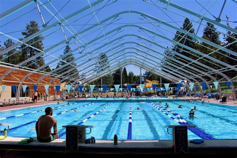
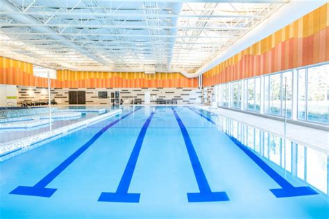
Juniper Swim & Fitness Center & Larkspur Community CenterEvent #124261
300 meters Swimming available both at Juniper Swim Center and Larkspur Community Center. Outdoor Olympic size covered pool set to 25 yd/m at Juniper for avid swimmers, while Larkspur has a warmer pool for a relaxing 300m swim for everyone. Swimming will help stretch and strengthen your overall body. And you get an event stamp. Tickets for admission to the pools available at the event Registration table.
|