Trail Ratings used for these events.

|
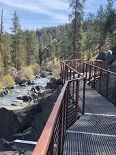
Terrebonne (Smith Rock) - Monkey See, Monkey DoEvent #118837
24 miles N of Bend on Hwy 97 5km, 10km - 2B (Monkey Face option 3C) Parking: $5/day or Oregon State Parks permit (available on site). Walk on trails along the Crooked River with sweeping views and opportunities to watch rock climbers, and see the iconic Monkey Face. |

|
Redmond - Tour d'ArtEvent #118838
18 miles N of Bend on Hwy 97 5 km, 10 km - 1A Enjoy the art and heritage of the town as well as the paved trails and parks through Dry Canyon, a nature preserve between steep volcanically formed canyon walls. |
|
Bend - Git around the block, Buster!Event #118839
5km, 11km - 2B Enjoy a stroll through downtown, city parks, and along the Deschutes River. This walk will pass by the last remaining Blockbuster video store on earth. |

|
Bend - Lava Island (fka Walk to the Raft)Event #118840
5 km, 10 km - 2B Please note that because of inadequate river flow this year, rafting is not possible during the time of our event. Starting at Seventh Mountain Resort, follow along the banks of the Deschutes River. You will be treated to fantastic views of the river, the plant and wildlife in the area, and some fantastic lava flows as well. |
|
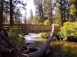
Bend - Shevlin ParkEvent #118841
5km - 1B, 10km - 2B A forest walk that includes huge larch and old-growth ponderosa, and several footbridges along Tumalo Creek. |
|
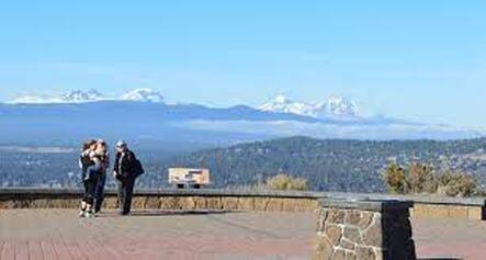
Bend - Pilot ButteEvent #118843
5km - 2B, 11km - 2B Pass through parks to an old cinder cone that affords views of Bend and the great expanse of Central Oregon in the distance. |

|
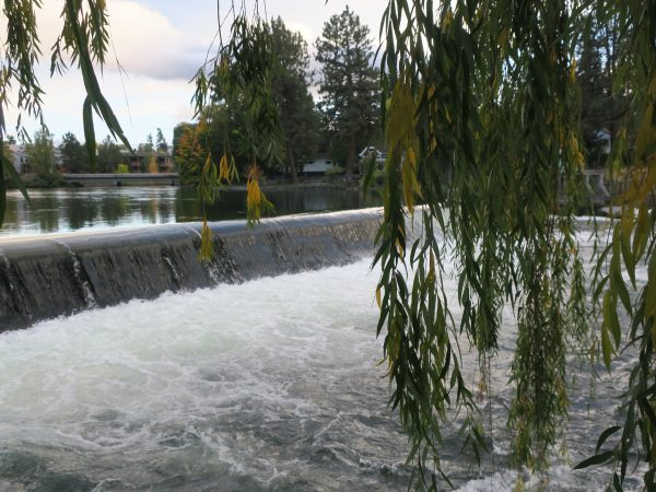
Bend - Benham Falls to Dillon FallsEvent #118844
Up to 15km - 2B Parking: $5/day or NW Forest permit (available on site). This spectacular section of the Deschutes River has some impressive whitewater. An opportunity to walk as far as you'd like past Benham Falls to several Day Use Areas and then to Dillon Falls and back. |
|
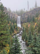
Tumalo FallsEvent #118845
14 miles W on NF-4601 and NF-4603 - Unpaved roads 6 km, 10 km, and longer options - 2B Parking: $5/day or NWForest Pass permit (available on site). Several distance options depending upon level and how many waterfalls we want to see. |
|
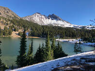
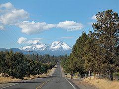
Green LakesEvent #118846
29 miles W of Bend on OR-372, NF-370 - Unpaved roads 5km, 15km or further - 2B Parking: $5/day or NW Forest Pass (available on-site) A Central Cascades Wilderness Day Use Permit is required for entry. The permits are nontransferable and only valid for entry on date and trailhead listed on the permit. Cost is $1. This is NOT the parking pass. To purchase: www.recreation.gov/ticket/300009/ticket/2003 Winding through a gentle forest along Fall Creek, pass several waterfalls and lava flows to the lakes with their vast views of South Sister, Mt. Bachelor, and Broken Top. Distance depends upon desire. |
|
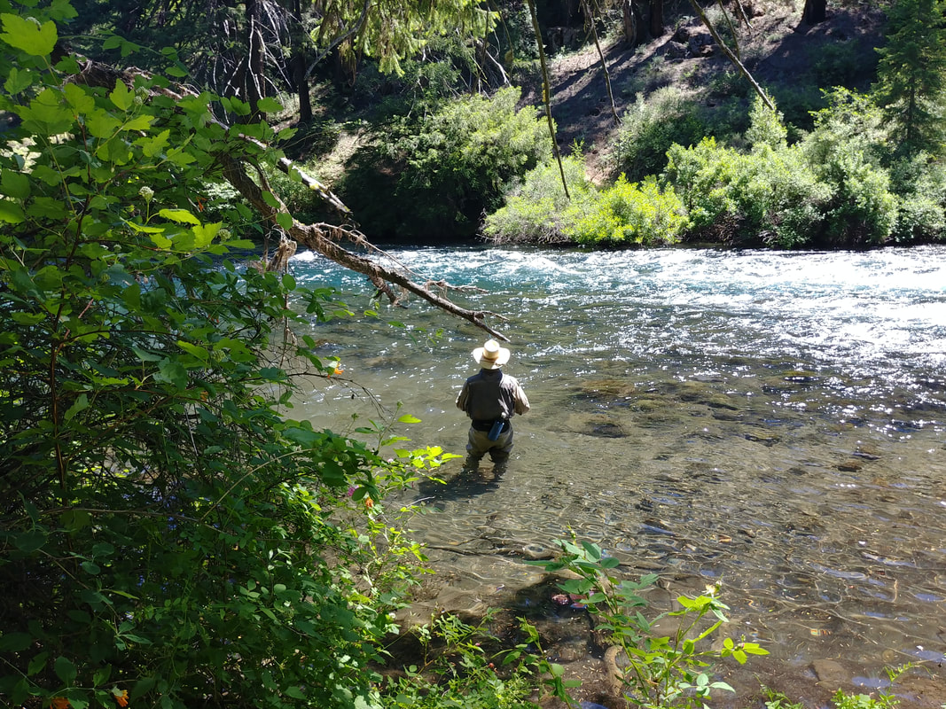
Camp Sherman - Metolius RiverEvent #118847
40 miles NW of Bend on Hwy 20 10km - 2B From Wizard Falls Fish Hatchery, walk downriver along the beautiful Metolius River known for fly fishing and cold, clear water, and then cross Lower Bridge and return, passing through a forest of pine, fir, and cedar trees. |

|
Sunriver - Village and LoopsEvent #118821
17 Miles S of Bend on Hwy 97 5km, 11km - 1A Explore the resort laced with paved trails through the Village (shopping, food), passing lodges and homes. |
|
LaPine - Paulina Lakeshore TrailEvent #11884830 Miles S of Bend on Hwy 97
13km - 2C Parking: $5/day or NWForest Pass (NOT available on site) This trail is a moderately difficult hike located within the scenic Newberry Volcanic Monument area. Elevation is at 6,350' at the trailhead start. This forested trail circumnavigates the lake, mostly flat with some uphill sections. Make a day of it and visit the Obsidian Flow and drive to the top of Paulina Peak. |
|
Bend - Riley Ranch to Tumalo State Park Event #118849
<5 Miles NW of Bend 5km, 11km - 2C 5 km route only: $5/day or Oregon State Parks pass From the open meadows of the nature preserve, descend one steep switch back area to get to the Deschutes River to hike to Tumalo State Park. (NOTE: This event is not near Tumalo Falls.) Dogs not allowed in the nature preserve. The shorter route (5 km) is available to those with dogs. |
Bikes
|
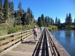
Tumalo - Twin Bridges
|
|
Bend - Sun-Lava PathEvent #118851
Route 11 miles Parking: $5/day or NWForest Pass (available on site) Ride the Sun-Lava paved trail from the Lava Lands Visitor Center to the Benham Falls area (Those with mountain/hybrid bikes could do that out-and-back section also), down to Sunriver and back. |
|
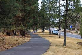
Bend - Century DriveEvent #118852
Route 10km Cruise along a paved bike trail on the outskirts of Bend enjoying the pine forests and typical high desert terrain. Enjoy the safety of a protected bike and pedestrian path while rolling along a gently undulating out-and-back trail. |
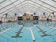
Swim
|
Juniper Swim & Fitness Center & Larkspur Community CenterEvent #119042
300 meters Swimming available both at Juniper Swim Center and Larkspur Community Center.
|